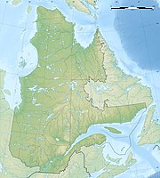
Penggunaan "Fail:Canada Quebec relief location map-conic proj.jpg" sejagat
Penampilan
This page shows where a file is used on other wikis. You can also find that information at the bottom of the file description page.

Penggunaan di ar.wikipedia.org
Penggunaan di de.wikipedia.org
- Magdalenen-Inseln
- Anticosti
- Mistassinisee
- Manicouagan-Stausee
- Caniapiscau-Stausee
- Gaspésie
- Pic Champlain
- Mont Babel
- Île Bonaventure
- Lac Saint-Jean
- Réservoir La Grande 3
- Gouin-Stausee
- Hochelaga-Archipel
- Lac Saint-Louis
- Lac des Deux Montagnes
- Île de Montréal
- Île d’Orléans
- Lac Saint-Pierre
- Mont Mégantic
- Lac Mégantic
- Lac Témiscouata
- Île Greenly
- Wikipedia:Kartenwerkstatt/Positionskarten/Nordamerika
- René-Levasseur-Insel
- Chaleur-Bucht
- Île de la Province
- Benutzer:Orci/Hilaire
- Île Sainte-Hélène
- Île Notre-Dame
- Isle des Allumettes
- Sendeturm Mont Royal
- Pingualuit-Krater
- Lac Minto
- Île Jésus
- Île Bizard
- Lac Wiyâshâkimî
- Parc national de la Gaspésie
- Mont Jacques-Cartier
- Parc national de Frontenac
- Parc national des Pingualuit
- Broadback Valley Forest
- Parc national du Mont-Tremblant
- Île des Sœurs
- Lac Tasiujaq
- Réservoir La Grande 4
- Lacs des Loups Marins
- Lac Matagami
- Lac D’Iberville
- Lac Bourdel
