Pergi ke kandungan

Fail:Paraguay - Location Map (2012) - PRY - UNOCHA.svg

Kandungan laman tidak disokong dalam bahasa lain.
Daripada Wikipedia, ensiklopedia bebas.

Fail asli (Fail SVG, ukuran dasar 250 × 250 piksel, saiz fail: 258 KB)

Paparkan gambar ini dalam .

Fail ini dari Wikimedia Commons dan mungkin digunakan oleh projek lain. Penerangan pada laman penerangan failnya di sana ditunjukkan di bawah.

Ringkasan

Keterangan
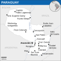
English: Locator map of Paraguay.
Tarikh
Sumber
Pengarang
SVG genesis
InfoField
 
The SVG code is valid.
 
This map was created with Inkscape.
 
 This map uses embedded text that can be easily translated using a text editor.

Perlesenan

w:ms:Creative Commons
pengiktirafan
Fail ini dilesenkan di bawah lesen Pengiktirafan 3.0 Tidak Diport Creative Commons.
Pengiktirafan: OCHA
Anda bebas:
  • untuk berkongsi – untuk menyalin, mengedar dan memindah hasil kerja
  • untuk mencampur semula – untuk menyesuaikan karya
Di bawah syarat berikut:
  • pengiktirafan – Anda mesti memberi penghargaan yang berpatutan, bekalkan pautan ke lesen, dan tunjukkan jika perubahan telah dibuat. Anda boleh lakukannya dalam sebarang cara yang munasabah, tetapi bukan dalam sebarang cara yang mencadangkan pemberi lesen mengendors anda atau penggunaan anda.
This map is part of a collection of 216 free country maps, created by the UN Office for the Coordination of Humanitarian Affairs (OCHA), to be used in print, web or broadcast products.

The ReliefWeb Location Maps released here are maps that highlight a country, its capital, major populated places and the surrounding regions.

Attribution Requirements

Using the map without modifications: ensure that the sources and the disclaimer are below the map. Credit as follows: "Credit: OCHA".

For use with alteration: remove the OCHA logo and disclaimer following any modification to the map, but keep the data sources as mentioned below the map. Credit the modified map as follows: "Based on OCHA map". You are responsible for the content of your map.

We are keen to receive your feedback and hear how you used OCHA's maps. We would be grateful if you would notify us by e-mail and share your work with us.

UN Disclaimer
The designations employed and the presentation of material of this map do not imply the expression of any opinion whatsoever on the part of the Secretariat of the United Nations concerning the legal status of any country, territory, city or area or of its authorities or concerning the delimitation of its frontiers or boundaries.
VRT Wikimedia

Keizinan untuk menggunakan hasil kerja ini adalah disahkan dan diarkibkan dalam sistem VRT Wikimedia.
Ia boleh didapati as ticket #2014031410007248 untuk pengguna yang mempunyai akaun VRTS. Jika anda berhajat untuk menggunakan semula hasil kerja ini di tempat lain, sila baca arahan di COM:REUSE. Jika anda adalah pengguna Commons dan ingin mengesahkan kebenaran, sila hubungi seseorang yang mempunyai akaun VRTS atau tinggalkan pesanan di papan kenyataan VRT.

Ticket link: https://ticket.wikimedia.org/otrs/index.pl?Action=AgentTicketZoom&TicketNumber=2014031410007248
Find other files from the same ticket: SDC query (SPARQL)


Textual information (e.g. timestamp) once visible in the image itself has been moved into the image metadata and/or image description page. This makes the image easier to reuse and more language-neutral, and makes the text easier to process and search for. Commons discourages placing visible textual information in images. All licenses accepted on Commons permit this type of modification as a derivative work. If attribution information were removed and the image is not public domain, replace this tag with {{Attribution metadata from licensed image}}.

беларуская (тарашкевіца)‎ | català | Deutsch | English | español | فارسی | français | galego | magyar | italiano | македонски | മലയാളം | português | русский | sicilianu | slovenščina | svenska | Indonesia | 中文 | +/−

Captions

Add a one-line explanation of what this file represents

Items portrayed in this file

menggambarkan

media type Inggeris

image/svg+xml

Sejarah fail

Klik pada tarikh/waktu untuk melihat rupa fail tersebut pada waktu itu.

Tarikh/WaktuGambar kenitUkuranPenggunaKomen
semasa04:03, 19 November 2022Gambar kenit bagi versi pada 04:03, 19 November 2022250 × 250 (258 KB)Pengetik-AMFile uploaded using svgtranslate tool (https://svgtranslate.toolforge.org/). Added translation for id.
18:08, 2 April 2016Gambar kenit bagi versi pada 18:08, 2 April 2016250 × 250 (258 KB)Wereldburger758Resized page to drawing. Removal watermark. Validation of image.
00:59, 8 Mei 2014Gambar kenit bagi versi pada 00:59, 8 Mei 2014254 × 254 (284 KB)UN OCHA maps bot== {{int:filedesc}} == {{Information |description={{en|1=Locator map of Paraguay.}} |date=2012 |source={{en|1=[http://reliefweb.int/map/paraguay/paraguay-location-map-2012 Paraguay Locator Map (ReliefWeb)]}} |author={{en|1=[[w:en:Unit...

Laman berikut menggunakan fail ini:

Penggunaan fail sejagat

Fail ini digunakan oleh wiki-wiki lain yang berikut:

Metadata